

Table of Contents
show
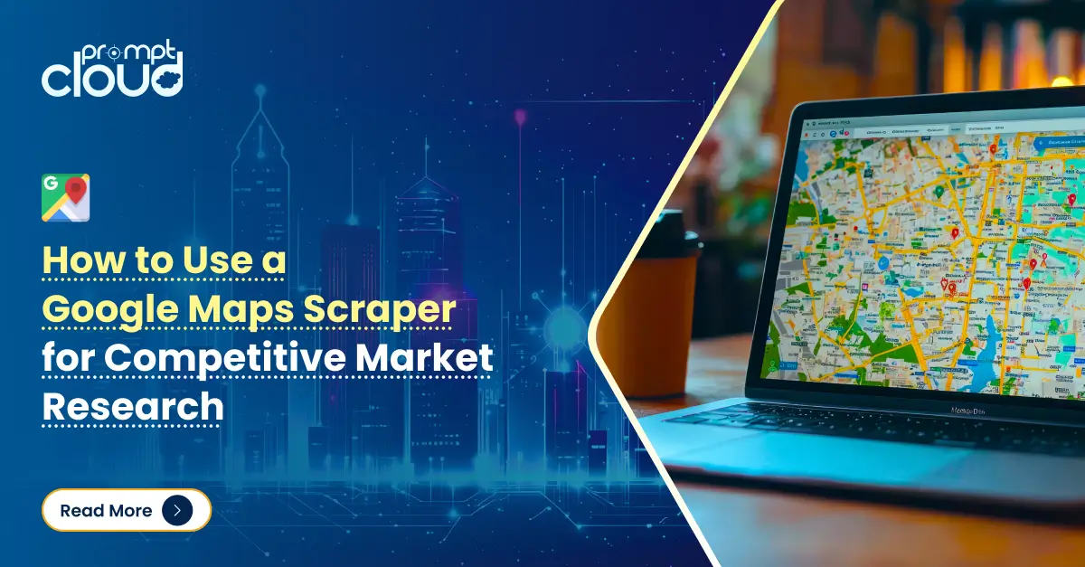
The strategic use of location-based information has become a driving force for organizations seeking to elevate their offerings, optimize their operations, and outpace competitors. In an era where consumers look for local solutions at the tap of a screen, having accurate, up-to-date geographical data is nothing short of transformative. While many business intelligence strategies involve direct consumer surveys or third-party datasets, a more direct approach has emerged: employing a google maps extractor to gather publicly available location-based insights. This approach opens the door to limitless possibilities, whether you’re trying to gauge market saturation, identify the perfect site for your next retail store, or track shifting consumer patterns in emerging neighborhoods.
Yet, extracting data from mapping services can be more intricate than it appears at first glance. The layers of information – coordinates, addresses, reviews, hours of operation, and even images—form a complex tapestry. Tapping into this trove involves methods that align with ethical and legal standards, maintain data quality, and work effectively at scale. By implementing a robust process or partnering with specialists who understand the nuances of an effective google maps extractor, businesses can streamline this effort, reducing time to insight while strengthening data-driven decision-making.
Why is Location Data Essential in Today’s Market Landscape?
Source: xMap
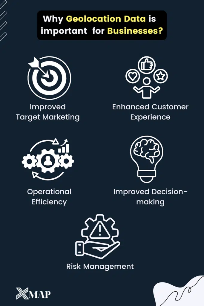
Why is location-based data so pivotal? At first glance, it might seem purely operational – logistics companies plan routes, retailers scout store locations, and real estate developers survey neighborhoods. But the potential expands far beyond tactical decisions. Marketers use geographic information to tailor campaigns to local preferences, property managers adjust pricing based on area demographics, and urban planners evaluate pedestrian flow when approving new infrastructure. In short, location-based insights drive both everyday tasks and big-picture strategies.
This is where a well-implemented google maps extractor can make a difference. Imagine wanting to identify every pet-friendly café, discover the average rating for short-term accommodations in a certain zip code, or locate the highest density of gyms within a metropolis. Collecting such data by hand would be painstaking, especially if you need to refresh your insights regularly. Instead, technology can sift through the platform’s public listings, capturing details at scale. The results feed directly into analytics models, from simple spreadsheet filters to advanced machine learning algorithms, turning raw data into timely actions.
In times of rapid change, such as unexpected shifts in consumer behavior or local regulations, real-time or near real-time location data is invaluable. Teams can react faster to evolving market conditions, adjusting pricing, store hours, or product lines based on factual, on-the-ground intelligence. A functional google maps extractor effectively becomes a sensor for the physical world, continually scanning for new signals that feed into strategic planning.
Real-World Applications of Location Data in Business Growth
The range of use cases for location-based insights is almost endless, but some themes consistently stand out. Take real estate development, for instance. Investors and developers regularly evaluate neighborhoods by analyzing local amenities, transportation routes, crime statistics, and upcoming government projects. While some data might come from official records, a properly implemented google maps extractor can fill in details about shopping malls, school ratings, and community centers. This holistic view clarifies which areas are prime for residential expansion and helps forecast property appreciation trends.
Another prominent application is competitive analysis. Suppose you plan to open a new restaurant. You might be interested in the density of eateries in a particular district, their average ratings, typical menu offerings, and price ranges. Rather than searching one by one, an automated system can compile a thorough dataset for your chosen geographic radius. This data might show a gap in the market—for example, a lack of vegan-friendly spots or fine dining for specific cuisines—and confirm whether your concept stands a good chance of success. By comparing user reviews, it’s also possible to uncover pain points that you can address in your own establishment, such as improved service or extended late-night hours.
Retailers looking at multi-city expansions find mapping services equally beneficial. With a robust google maps extractor, they can gauge foot traffic potential near certain intersections by correlating local listings (like coffee shops, coworking spaces, or gyms) with publicly available demographic data. The presence of certain amenities can act as a proxy for target audience concentration. Marketers, on the other hand, can use this data to plan localized campaigns or events. Even nonprofits or civic planners stand to gain, understanding how community resources—libraries, clinics, shelters—are distributed, and identifying underserved neighborhoods.
Overcoming Common Issues in Large-Scale Location Data Extraction
While the utility of location information is straightforward, the path to acquiring it in large volumes is less so. Mapping services often update their interfaces, introduce new anti-automation measures, or reformat data fields to enhance user experiences. These changes can disrupt extraction pipelines if they’re not designed to be adaptive. A static system that only parses HTML in a single, unchanging pattern might break at the slightest platform tweak.
Moreover, the data itself can be noisy. Some listings may have outdated information, while others could be duplicates. Another factor is user-generated content—business categories, reviews, and photos may vary widely in quality. For analytics teams seeking uniform results, extensive cleaning and deduplication become necessary. This is why many companies turn to specialized solutions that can function as a reliable google maps extractor, implementing measures such as rotating IP addresses, respecting usage guidelines, and employing real-time error correction to keep data pipelines stable.
Ethical and legal considerations are no small matter either. Platforms that share location data rely on user trust, and violating that trust with aggressive or unauthorized scraping can harm reputations or lead to legal consequences. Organizations must adhere to publicly available terms of service, local data privacy regulations, and fair use principles. Responsible data collection is about more than compliance— – it’s about maintaining a stable, mutually respectful ecosystem where businesses can glean insights without exploiting or undermining the platform.
Steps to Convert Extracted Data into Actionable Insights
Collecting extensive records of addresses, phone numbers, and ratings is only the first step. To unlock real value, organizations must integrate these location data points into broader analytical frameworks. For instance, you might feed this dataset into a machine learning model that predicts the success rate of new store openings based on the concentration of complementary businesses. Alternatively, you might run geospatial analyses to see how certain areas have changed over time, using historical snapshots to identify growth patterns.
Contextual enrichment amplifies these efforts. Combining location data with external information—such as census figures, consumer spending indexes, or local weather reports—adds dimensions to the analysis. A coffee chain, for example, might cross-reference average household income in a district with the local frequency of visits to popular cafés. If your google maps extractor pipeline operates in near real-time, you can also test out short-term promotions or store hours changes, then measure how quickly local listings reflect an uptick in reviews or brand mentions.
Visualization often plays a key role too. Geo-mapping extracted data makes it easier to spot clusters of high-rated establishments, travel corridors, or potential “food deserts” in urban areas. Various data intelligence platforms offer interactive dashboards that let stakeholders filter and drill down, uncovering micro-level insights with just a few clicks. These visual tools can bridge the gap between raw data and strategic decisions, making it clear where to expand, where to pivot, or how to differentiate an offering based on local competition.
Real-World Impact of Location Intelligence on Business Strategies
The practical outcomes of harnessing a steady data pipeline from mapping services are varied and impressive. Consider a large multinational retailer evaluating potential sites for pop-up stores. By quickly processing thousands of local listings, they discover neighborhoods that skew younger and are anchored by popular nightlife spots – ideal for showcasing a limited-edition fashion line. Alternatively, a chain of pharmacies could overlay competitor coverage on top of healthcare demand indicators, pinpointing communities in dire need of accessible medical supplies. In each scenario, location intelligence drives more targeted investments and more confident expansions.
Smaller enterprises benefit too. An up-and-coming food truck operation, for instance, might use a google maps extractor to track festivals, seasonal events, and newly opened businesses in different parts of the city. They can then reposition their trucks in areas with the highest synergy or foot traffic, effectively maximizing daily revenue. Even digital startups looking to operate in the travel or tourism space rely on aggregated location data for curated guides, trip planning tools, or local discovery apps. By capturing specific categories – like historical monuments, scenic viewpoints, or budget-friendly accommodations – they build unique experiences that resonate with modern travelers.
Moreover, the sudden interest in hyper-local marketing—where companies tailor offerings to the immediate environment – underscores the importance of real-time location data. Think of a restaurant chain that wants to roll out a citywide “happy hour” but customize the timing based on each neighborhood’s typical foot traffic patterns. With an automated feed capturing local events, competitor promotions, and user feedback, they can adjust the exact hours or menu items accordingly, boosting both brand relevance and profitability.
How Partnering with Experts Ensures Seamless Data Extraction?
Despite the allure of extracting data directly from a mapping platform, the technical and compliance hurdles can be steep. Building an in-house solution for a google maps extractor requires ongoing maintenance, specialized expertise in web scraping, and robust infrastructure to handle large-scale requests. Some businesses attempt to manage it all internally, but the cost in time and resources can quickly balloon.
This is why many organizations opt to partner with professional data providers. These providers have established frameworks for acquiring public data ethically, scaling up or down as needed, and integrating with existing analytics stacks. They remain vigilant about updates to website structures, deploying adaptive crawlers that can handle HTML changes or new rate-limiting measures. By offloading these challenges, companies focus on gleaning insights, refining strategies, and innovating in their core competencies.
In the end, it’s not just about data acquisition; it’s about forging a long-term data strategy. When the pipeline is reliable, refreshed frequently, and easily ingested into analytics platforms, decision-makers can incorporate location intelligence into every facet of their planning. From executive-level expansions to frontline marketing campaigns, the entire organization benefits from a shared, accurate view of how their market is laid out.
The Future of Localized Data: What Businesses Need to Know?
As digital tools merge seamlessly with our physical environment, location data grows in both volume and importance. Users rely on mapping platforms for daily errands, route planning, and exploring new neighborhoods. Businesses, in turn, see an opportunity to refine their offerings by analyzing these digital footprints. The synergy of real-time mapping, user feedback, and advanced analytics heralds a future where location-based insights sit at the heart of most business processes.
Maintaining a robust, up-to-date location dataset will become an enduring priority, not a one-off project. With the right google maps extractor solution in place—one that respects ethical boundaries and handles site changes deftly—organizations can treat location data as an ongoing resource. They can track how communities evolve, how consumer preferences shift geographically, and how new startups or trends gain a foothold in certain locales. The capacity to observe these developments in near real-time translates to strategic agility and brand relevance.
Whether you’re exploring new markets, seeking to optimize local advertising, or planning store expansions, location data isn’t just a supporting actor; it’s often the lead role in a script that outlines competitive advantage. In an economy driven by rapid change and fragmented consumer attention, having your finger on the pulse of physical reality can be a decisive factor. By investing in a dependable approach to data extraction—via an expertly built google maps extractor—businesses arm themselves with the insights necessary to innovate, adapt, and thrive.
Conclusion
Extracting data from mapping services transforms everyday observations into strategic insights. Modern businesses across industries—retail, hospitality, real estate, healthcare – stand to gain from regularly updated, carefully cleaned location information. It doesn’t stop at generating lists of addresses; it extends to interpreting consumer reviews, analyzing foot traffic, and preempting competitor moves in neighborhoods that show signs of rapid growth.
To remain competitive, brands must recognize how critical these platforms have become, not just for individual users but for the entire commercial landscape. The opportunity to harness these insights responsibly and effectively can fundamentally shift how companies plan, operate, and engage with their communities. By integrating a capable google maps extractor into your data strategy, you’ll be better equipped to navigate the ever-changing terrain of local business ecosystems – while uncovering opportunities that less data-savvy rivals overlook. For data extraction solutions, get in touch with us at sales@promptcloud.com